 EMERGING TECH
 EMERGING TECH
 EMERGING TECH
Facebook Inc. announced a new disaster relief initiative today that will put its huge stores of user data in the hands of emergency response organizations.
Coordinating relief efforts during major disasters is tough, and it can be difficult to know what areas are in the most immediate need for help. Facebook is looking to solve that problem by using anonymized user data to build detailed maps of affected areas.
Molly Jackman, public policy research manager at Facebook, said that the new project is aimed at helping relief organizations “paint a more complete picture of where affected people are located.” Jackman says this information will make it easier for these organizations to determine how important resources such as food and medical supplies should be allocated.
The maps will rely partly on Facebook’s existing Safety Check feature, which allows users affected by disasters to notify their friends and loved ones that they are safe. This information will be used to show heat maps of where users who consider themselves “safe” are located, as well as which areas users are avoiding.
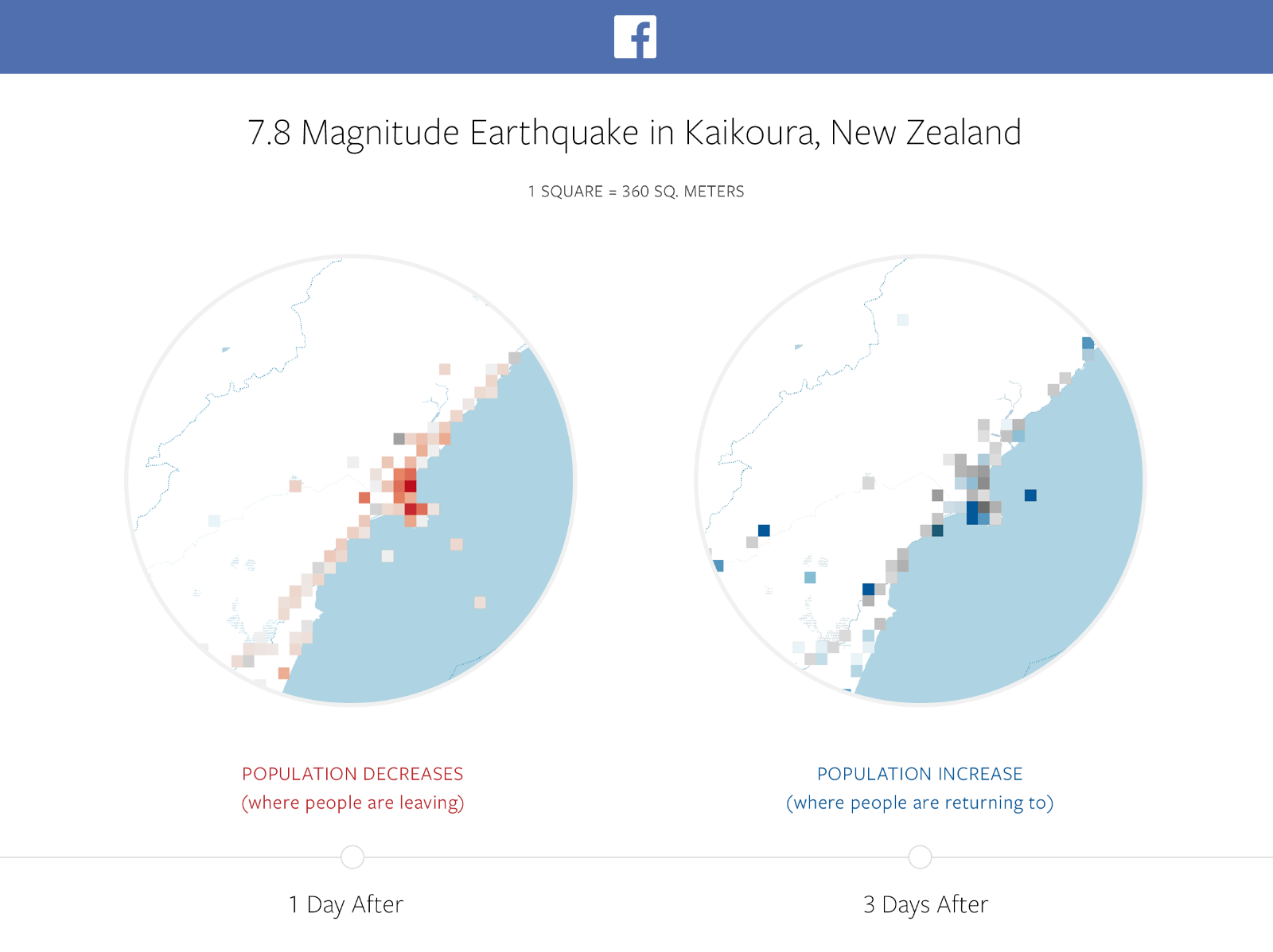
Facebook’s disaster maps will also compared population density in an area from both before and after the disaster, and they will also show movement patterns for groups of people over a period of several hours. According to Facebook, this will demonstrate which areas have been hit hardest and will help emergency responders predict where large groups of people will gather.
As with all things Facebook, the new disaster maps project raises some concerns over user privacy, but the social media giant is quick to point out that the data will be de-identified and will only be available to approved relief organizations in times of disaster.
“We are sharing this information with trusted organizations that have capacity to act on the data and respect our privacy standards, starting with UNICEF, the International Federation of the Red Cross and Red Crescent Societies, and the World Food Programme,” Jackson said. “We are working with these organizations to establish formal processes for responsibly sharing the datasets with others.”
Jackson added that the company plans to allow more organizations and government agencies to participate. “All applications will be reviewed carefully by people at Facebook, including those with local expertise.”
Despite Facebook’s assurances of privacy, the disaster maps project still demonstrates the sheer volume of data available to the social network, allowing it to track the location and movement patterns of individual users across the globe.
Support our open free content by sharing and engaging with our content and community.
Where Technology Leaders Connect, Share Intelligence & Create Opportunities
SiliconANGLE Media is a recognized leader in digital media innovation serving innovative audiences and brands, bringing together cutting-edge technology, influential content, strategic insights and real-time audience engagement. As the parent company of SiliconANGLE, theCUBE Network, theCUBE Research, CUBE365, theCUBE AI and theCUBE SuperStudios — such as those established in Silicon Valley and the New York Stock Exchange (NYSE) — SiliconANGLE Media operates at the intersection of media, technology, and AI. .
Founded by tech visionaries John Furrier and Dave Vellante, SiliconANGLE Media has built a powerful ecosystem of industry-leading digital media brands, with a reach of 15+ million elite tech professionals. The company’s new, proprietary theCUBE AI Video cloud is breaking ground in audience interaction, leveraging theCUBEai.com neural network to help technology companies make data-driven decisions and stay at the forefront of industry conversations.