 APPS
APPS
 APPS
APPS
 APPS
APPS
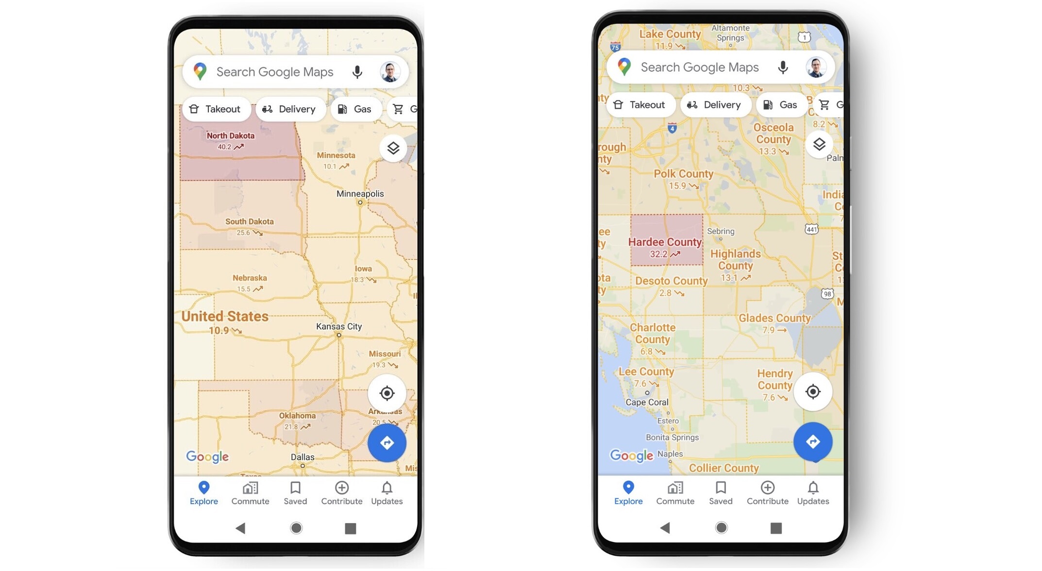
Google LLC said today it’s adding a new layer to the Google Maps app that displays information about COVID-19 outbreaks in every country where data is available.
Google Maps product manager Sujoy Banerjee said the COVID-19 layer will display information about the disease for all 220 countries and territories supported by the app. Users will be able to see how many outbreaks of COVID-19 there are at a state or province, county and city-level, so long as there is data available.
Google said it will take its information from “multiple authoritative sources,” including Johns Hopkins University, The New York Times and Wikipedia, which use data supplied by the World Health Organization and government health ministries, as well as local health agencies and hospitals. Google uses the same sources to provide COVID-19 data in its search results.
The new layer displays a basic seven-day average of new COVID-19 cases per 100,000 people in any given area, Banerjee said. It also uses color coding so users can quickly see the density of new cases in an area, and there are labels to show if cases are currently trending up or down.
The addition of the COVID-19 layer is another example of how technology is working for good during difficult times, said Constellation Research Inc. analyst Holger Mueller.
“Map applications reflect the real world and are enriched with data,” Mueller said. “During these pandemic times, people want access to geographic COVID-19 data, and Google is providing that with its new COVID-19 layer.”
Google has been active in tracking cases of COVID-19, providing detailed information via its search results ever since the outbreak began. The company has also partnered with Apple Inc. to create an Exposure Notifications System and application programming interface that helps governments and other agencies to develop contact tracing applications quickly.
Google said the COVID-19 layer in Maps is rolling out to users via an update this week.
Support our mission to keep content open and free by engaging with theCUBE community. Join theCUBE’s Alumni Trust Network, where technology leaders connect, share intelligence and create opportunities.
Founded by tech visionaries John Furrier and Dave Vellante, SiliconANGLE Media has built a dynamic ecosystem of industry-leading digital media brands that reach 15+ million elite tech professionals. Our new proprietary theCUBE AI Video Cloud is breaking ground in audience interaction, leveraging theCUBEai.com neural network to help technology companies make data-driven decisions and stay at the forefront of industry conversations.