


 NEWS
NEWS
NEWS
NEWS
NEWS
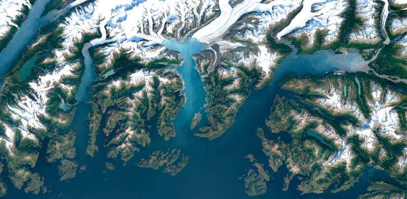
Google has updated the satellite imagery it uses in Google Maps to provide users with a more superior view of Earth from above.
The new imagery comes from NASA’s Landsat 8 satellite, and combined with new processing techniques not only provides sharper images than before, but cloud-free imagery as well by stitching together millions of images.
According to Google, Landsat 8 captures images with great detail, truer colors, and at an unprecedented frequency in that it captures twice as many images as Landsat 7, its predecessor, does every day; Landsat 7 also suffered a hardware failure in 2003 that resulted in some portions of the world having diagonal gaps of missing data.
If that doesn’t sound interesting enough, the numbers in terms of the data processed are staggering, even to those who might not fully understand what they mean: using the publicly available Earth Engine API’s Google mined data from nearly a petabyte, that is one million gigabytes, of Landsat imagery that included over 700 trillion individual pixels, a number that is said to be 7,000 times more pixels than the estimated number of stars in the Milky Way Galaxy, or 70 times more pixels than the estimated number of galaxies in the universe.
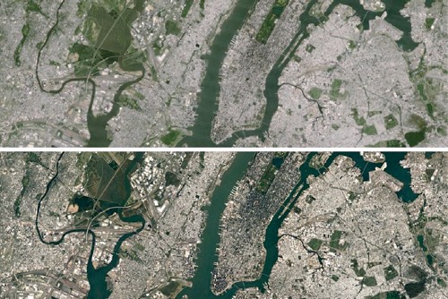
The results speak for themselves with the following being imagery of New York City before and after the update:
The new imagery itself is made possible as NASA, in collaboration with the United States Geological Survey makes its Landsat database open source for anyone to make use of, although the final result in Google Maps is only so pretty due to the secret sauce of Google technology applied to stitch the imagery together.
For many the changes may not make a huge difference, but for those who like the Earth view in Google Maps, it’s a welcome change.
To check out the new imagery where you live visit Google Maps, select the earth view, then zoom on in.
Support our mission to keep content open and free by engaging with theCUBE community. Join theCUBE’s Alumni Trust Network, where technology leaders connect, share intelligence and create opportunities.
Founded by tech visionaries John Furrier and Dave Vellante, SiliconANGLE Media has built a dynamic ecosystem of industry-leading digital media brands that reach 15+ million elite tech professionals. Our new proprietary theCUBE AI Video Cloud is breaking ground in audience interaction, leveraging theCUBEai.com neural network to help technology companies make data-driven decisions and stay at the forefront of industry conversations.