


 BIG DATA
BIG DATA
BIG DATA

BIG DATA
The modernization of the IT infrastructure allows enterprises to be more efficient, innovate and do this at scale. Using these new technologies, geospatial analytics company Orbital Insight Inc. gathers numerous types of location data and applies artificial intelligence and analytics to them in order to answer businesses’ questions.
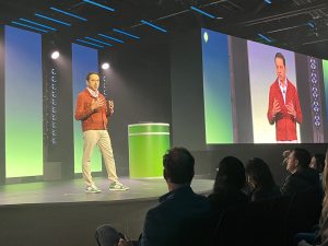
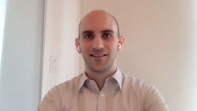
Although not originally a microservice platform, Orbital took over the world of cloud native technology, containers and Kubernetes, as it needed to be able to scale different parts of its system, according to Matt Falk (pictured), vice president of engineering, data science and computer vision at Orbital.
“Whether it was scaling to ingest more data, scaling to involve new algorithms or scaling really to involve or be able to compute massive computation requests that come from our customer, this requires different pieces of our system to scale,” he said. “If we were a monolithic application, if we were running on-premise, that type of scale just wouldn’t really be possible.”
Falk spoke with John Furrier, host of theCUBE, SiliconANGLE Media’s livestreaming studio, during DockerCon. They discussed the Orbital technology and use cases, the adoption of artificial intelligence and analytics to gain insights from the data, and how modern applications are essential for the company to meet the technical challenges. (* Disclosure below.)
Orbital analyzes satellite, drone, balloon and other unmanned aerial vehicle images, including cell phone geolocation data, to study a range of human activity and provides business and other strategic insights from the data.
When it started about eight years ago, the big data wave was just building. There were not that many satellite providers. and there were not as many different types of geospatial data as there are today. Thus, it was not clear how these data could be used.
In recent years, data has become more abundant, with many new types of disparate sources, and several new use cases have emerged as well, according to Falk. Now, it all comes down to merging all kinds of data to get more insights.
“The most exciting thing is really just how much of that data exists and how much is going to exist in the next few years, and, honestly, we want to ride that tidal wave along with our customers,” Falk said. “It’s sci-fi, but it is here.”
In the early years of operation, Orbital used to talk to customers, listen to their pain points and develop a data solution specific to the use case, which did not allow scaling as needed.
After identifying that there were many similarities and overlaps between customer problems, Orbital decided to develop this on a generic platform, called GO, which can usually resolve any question about geospatial data analytics, according to Falk.
“So instead of, ‘I have a very specific problem. I wanted to count the number of trees in this particular area,’ it is ‘No, no, you want to do something similar to land use,’” he said. “You want to try and classify different areas of the planet that are covered in this particular type of land use and then use that as an estimate for how many trees there are.”
Dealing with geospatial data involves many technical challenges, according to Falk. In the case of images captured by satellite miles away from the planet, for example, the resolution is very poor.
“If we go outside and we stand in a satellite image, the best commercial sensors today, we’re at most one pixel, and with one pixel you really can’t identify people,” he explained.
Another challenge is related to what he calls “temporal resolution.” This is because many image sources do not get an image every day, or even every week, which causes a time lag between one and the other that can compromise inferences.
“So how do you impute different data, impute different points to make your overall analysis worthwhile?” he asked.
There are still issues related to geo-registration or orthorectification. When a satellite obtains an image of some place on the planet, it is not possible to know precisely where that image is. It can be 5, 10, 15 or 20 meters apart, and work needs to be done to relocate that image to the correct specific position. Orthorectification refers to the angle at which the image was taken, which also needs to be understood correctly.
“So, for satellite imagery, for other data sources too, there’s a slew of additional challenges that we have to compete, that we have to fix and work with to make this data usable,” Falk stated. “And that’s what our platform does; it takes this data, it fixes all those issues and allows you to compute the analytics on top of them.”
Orbital adds value for customers in two main ways. One is that the company makes the data available to them. It is too expensive to buy these disparate data sources if the company has only one particular, single need for them, according to Falk.
“So, the first thing our platform does is it integrates with many different data providers, it integrates with anything that has a latitude and longitude with it,” he said. “And we become the broker almost, the provider of all that disparate data into a single unified source.”
The second piece is the analytics. Depending on the interest of the enterprise – where it wants to look on the planet, what it wants to look for and when it wants to look for it — the Orbital platform takes care of getting all the necessary information and applying personalized analytics to produce the expected insights.
“What comes out of the platform is effectively a time series that you’re able to go explore and drill down into further,” Falk concluded.
Watch the complete video interview below, and be sure to check out more of SiliconANGLE’s and theCUBE’s coverage of DockerCon. (* Disclosure: Docker Inc. sponsored this segment of theCUBE. Neither Docker nor other sponsors have editorial control over content on theCUBE or SiliconANGLE.)
Support our mission to keep content open and free by engaging with theCUBE community. Join theCUBE’s Alumni Trust Network, where technology leaders connect, share intelligence and create opportunities.
Founded by tech visionaries John Furrier and Dave Vellante, SiliconANGLE Media has built a dynamic ecosystem of industry-leading digital media brands that reach 15+ million elite tech professionals. Our new proprietary theCUBE AI Video Cloud is breaking ground in audience interaction, leveraging theCUBEai.com neural network to help technology companies make data-driven decisions and stay at the forefront of industry conversations.